Flight Videos
Flight information for corporate jet pilots visiting New Zealand and the Pacific Islands
Limitation of liability – For reference purposes only
The information contained in the multimedia content (“Video Content”) below, is made available for informational and reference purposes only. Air Center One does not make any representation or warranties with respect to the accuracy, applicability, fitness, or completeness of the Video Content.
The Video Content is not intended to be a substitute for flight planning or the use of up-to-date navigational data or charts. Always follow the procedures as laid out in your company’s operations manual, performing your due diligence for the intended airport, and accept advice from other suitably qualified professionals with any questions you may have regarding the specific aerodrome. Never disregard your planning, procedures, or professional advice, because of something you have read or seen on the Site.
Air Center One hereby disclaims any and all liability to any party for any direct, indirect, implied, punitive, special, incidental, or other consequential damages arising directly or indirectly from any use of the Video Content, which is provided as is, and without warranties.
VOR/DME C: Circling approach for RWYS 05 and 23
This is a video of the VOR/DME C: Circling approach for RWYS 05 and 23 at Queenstown (NZQN).
Runway 23 Cardrona Saddle approach path at Queenstown ( NZQN)
This is a video of the Runway 23 Cardrona Saddle approach path at Queenstown (NZQN).
Runway 23 VOR/DME approach path at Queenstown ( NZQN)
This is a video of the Runway 23 VOR/DME approach path at Queenstown (NZQN).
The initial inbound track is 260 Deg and the video commences approx 8 miles from Slopehill VOR. MDA for Cat A,B and C aircraft is 4,240 ft. Max IAS is 160 Knots.
The video track flown breaks off at D3.0 and shows a visual approach path via a left descending turn overhead Lake Hayes to position with a right turn at around 1,800 ft onto final for Runway 23.
On final approach up the river the Remarkable Mountains slope up to the left with Morven Hill on the right. Be aware of turbulence in strong southwesterly wind conditions.
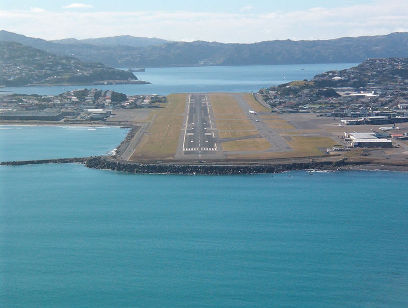
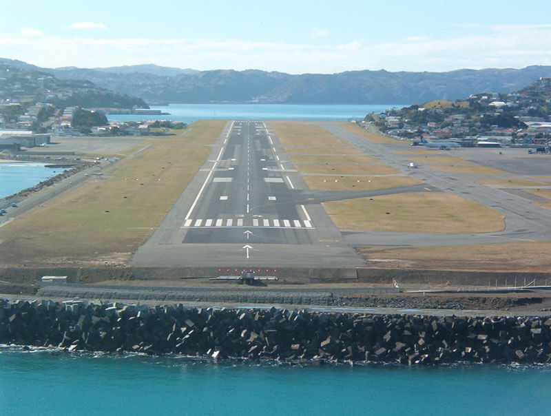
Approaches to runway 34 at Wellington airport